With curiosity we steered off the asphalt at the top of a long climb on the road south of Honeydew. The track plunged down through dense forest, rocks and loose gravel shaking our bikes and bones, disc brakes squealing round sketchy hairpins, as the King Range Road wound its way down to the gushing creek in the depths of the valley, where an old concrete bridge had once been plonked.

This was protected land, now; nobody lived here, and the road evidently saw precious little use. I clambered down the bank and leaped into an eddying pool of clear ice-cold water, the perfect antidote to the grinding climb and the clattering downhill that had brought us here.

At the back of my mind was the impending climb up the far side of the valley wall. Sitting around in the sun to dry off, it was easy to linger. But lingering would not soften the task, and soon enough we set out to tackle the loose dirt. I dug into the climb, which took no prisoners — back into first gear, out of the saddle, making excruciatingly slow progress uphill amongst eroded rain-channels and loose rock, splashing through streams that tumbled down the forested mountainside between the rocky spurs and fed the widening creek in the valley that slowly fell away beneath me. Nothing but silence and birdsong accompanied my slower-than-walking-pace progress, but speed was not of the essence here: slow and steady wins the race.

The bike I was riding was designed for all-round expeditioning, and while the mountain-bike setup I used to ride would have tackled this terrain with gusto, I was still impressed with the way in which the Sutra was handling off-road riding. Sure, I couldn’t take these bumpy downhills at speed, and I was still fantasizing about smaller gears during the steepest of the uphills. But there were no spills, breakages or sketchy moments, nor did I have to get off and push, in spite of some of the steepest grades I’d attempted. In fact I was enjoying this more than any of the riding I’d done until now.

I relished the change in routine at a deep level because this place — the far side of the bend, the invisible summit — was playing to my curiosity; I was eager for the boundaries of my experience to be pushed out. Learning is a core part of why I seek out adventure and take delight in the process of discovery. This difficult, remote and otherworldly detour — in Northern California, of all places! — had great potential to teach.
And on a simpler level, I simply relished the challenge; the absurd urge to assert myself over the elements and the obstacles, negotiating unpredictability and pain and fatigue to reach some imagined finishing line of which I was the sole designer and judge. This kind of occasional and enjoyable buzz is something I feel no need to elevate myself above.

“This really isn’t my idea of fun”, said Ben as he rolled to a halt beside me. As far as he was concerned, this was just a really shit road, a pointless exercise in the endurance of pain and suffering. I had few words in reply, other than that it would come to an end relatively quickly.
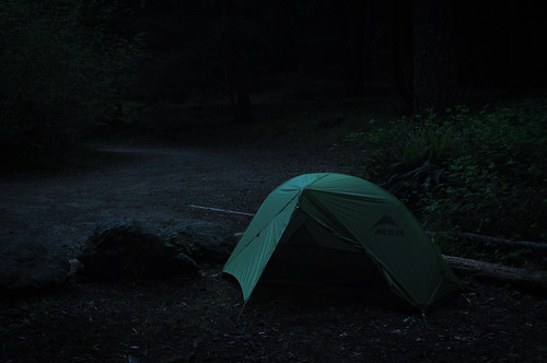
And it did: later in the afternoon we were spat out on a paved road. One direction led to Shelter Cove, by far the biggest settlement in the southern part of the Lost Coast. The other direction would lead us further south to the start of Usal Road, which short of turning back to Honeydew was now our only option for leaving the Lost Coast and meeting the paved coastal route. A tiny primitive campground appeared and Ben promptly collapsed in an exhausted heap while I walked and hitch-hiked back to Shelter Cove for supplies.
We awoke the following morning and set out for Usal Road, climbing above the clouds and finding ourselves riding on in a hidden paradise of exotic flora and rare tranquility. We quickly found the junction, and the warning signs were clear; use this route at your own risk. This seemed to confirm the stories we’d heard — nobody we’d spoken to in the area had any idea whether or not we’d be able to get through, and many had stories of a terrifying journey they’d once taken that way many years or decades ago.

But we hadn’t come this far to be put off by such things: this was the adventure we’d come to the Lost Coast in search of. Ben remarked on how amazing it was to be able to ride until he could barely stand up, yet be ready to tackle it all over again after a short night’s sleep in a tent. And we set off past the warning signs, past the barrier, began to descend into the clouds, and were soon past the point of no return.

I wasn’t disappointed: I neither saw nor heard a human, vehicle or building for the entire day, as the washed-out track wound mercilessly up and down amongst the jungle-ridden peaks and chasms that had defeated generations of American road-builders. This remote and challenging road easily earned a place at the very top of my list of favourite rides on the West Coast.

The funny thing was that for all the talk and build-up it really wasn’t so remote: twenty or thirty miles between the last asphalt on the Lost Coast and the switchback track down to meet Highway 1 as it emerged back onto the coast, easily dwarfed in remoteness and challenge by any number of sections in Mongolia or Sudan or Ethiopia I cared to recall. Yet it was still talked of locally as if it were the end of the Earth.

And a constant reminder of the relative accessibility of the so-called Lost Coast was visible throughout the day: another two distinct pairs of bicycle tyre-marks leading us along, slick-patterned and narrow, freshly beaten into the dirt, taunting us with their presence: whatever hardship we endured, whatever efforts we expended, somebody else had done it first. Somebody so close up ahead!

Ben and I followed the tracks as they wove in and out of visibility. Well within a day’s ride of us — as we struggled up inclines steep enough to topple a bike back over its own rear wheel — two other intrepid riders were destroying any illusions that our conquering of Usal Road was a remotely unique or notable feat.

We never did manage to catch them up.
My U.S. Pacific Coast ride is kindly supported by Kona Bikes, Cascade Designs and Schwalbe. Read more about the gear they’ve supplied.
Something to add?